Hej hej! (This is the standard greeting in Sweden – pronounced ‘hey hey’ and always said in an upbeat tone, regardless of your actual mood.) I had big plans to write up our travels in chronological order, but this Swedish adventure is fresh in my mind so I’ve decided to get it down. I’ll warn you, it’s bound to be a long one; we were walking for 8 days and there is a lot to tell – maybe grab yourself a cuppa if you are planning to read this in one go.
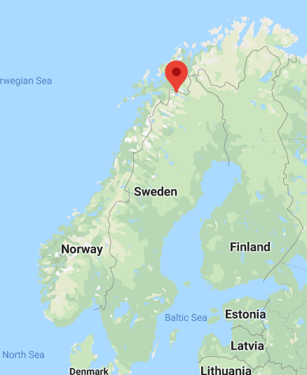
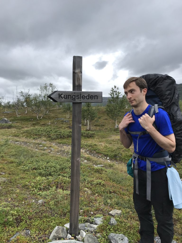
This holiday came about because Stu had been researching multi-day hikes in Scotland (classic) and came across a recommendation to try Sweden’s trails. He sold it to me as a week of hiking in beautiful scenery, with the option to stay in mountain cabins along the way. In a poor attempt to pull my weight with the planning, I did some browsing online before we went. I learnt that the Kungsleden, or ‘King’s Trail’, is apparently one of the world’s most famous hiking trails (although I hadn’t heard of it). It’s right at the top of Sweden, in the Arctic Circle, and the full trail is around 440km. The northernmost section from Abisko to Nikkaluokta is the most popular and accessible – that’s the bit that we were going to tackle. And that’s pretty much all I knew going into it.
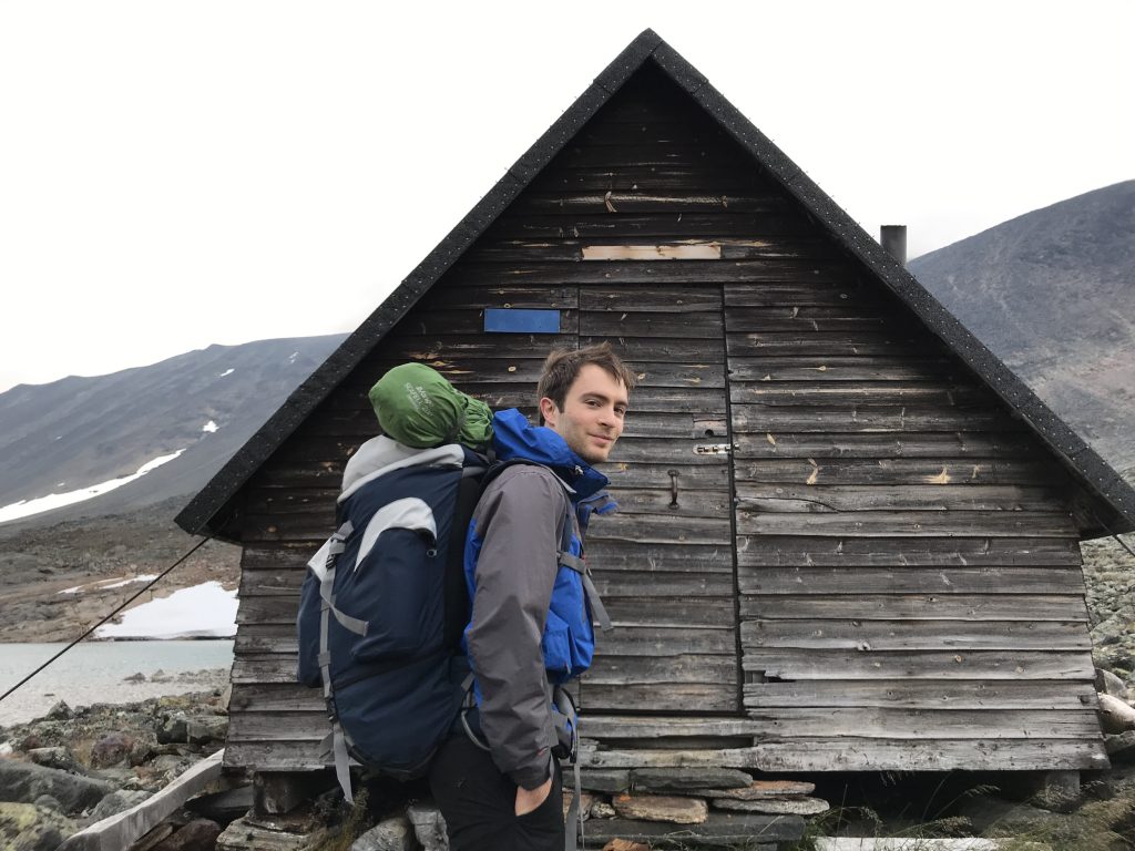
Stu looked into the details of the mountain cabins, which you don’t have to pre-book and where you are guaranteed a place to sleep (even if just a mattress on the floor). I quite liked the sound of these, but you can also camp and I conceded that a couple of nights of this might be nice too. Guess how many nights we stayed in a bed? One. Out of nine nights. Stu managed this by arriving at a cabin and checking the price for a bed versus a camping spot, and then looking at me imploringly. Sweden is expensive, so at around £40 per person for a bed in a shared cabin with no electricity, running water or flushing toilets, the decision was made for us. Of course, Stu knew all of this going into it; it will go down as one of his greatest mis-sellings.
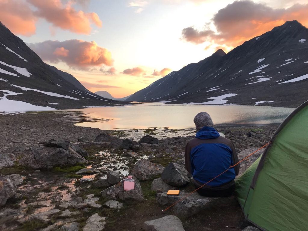
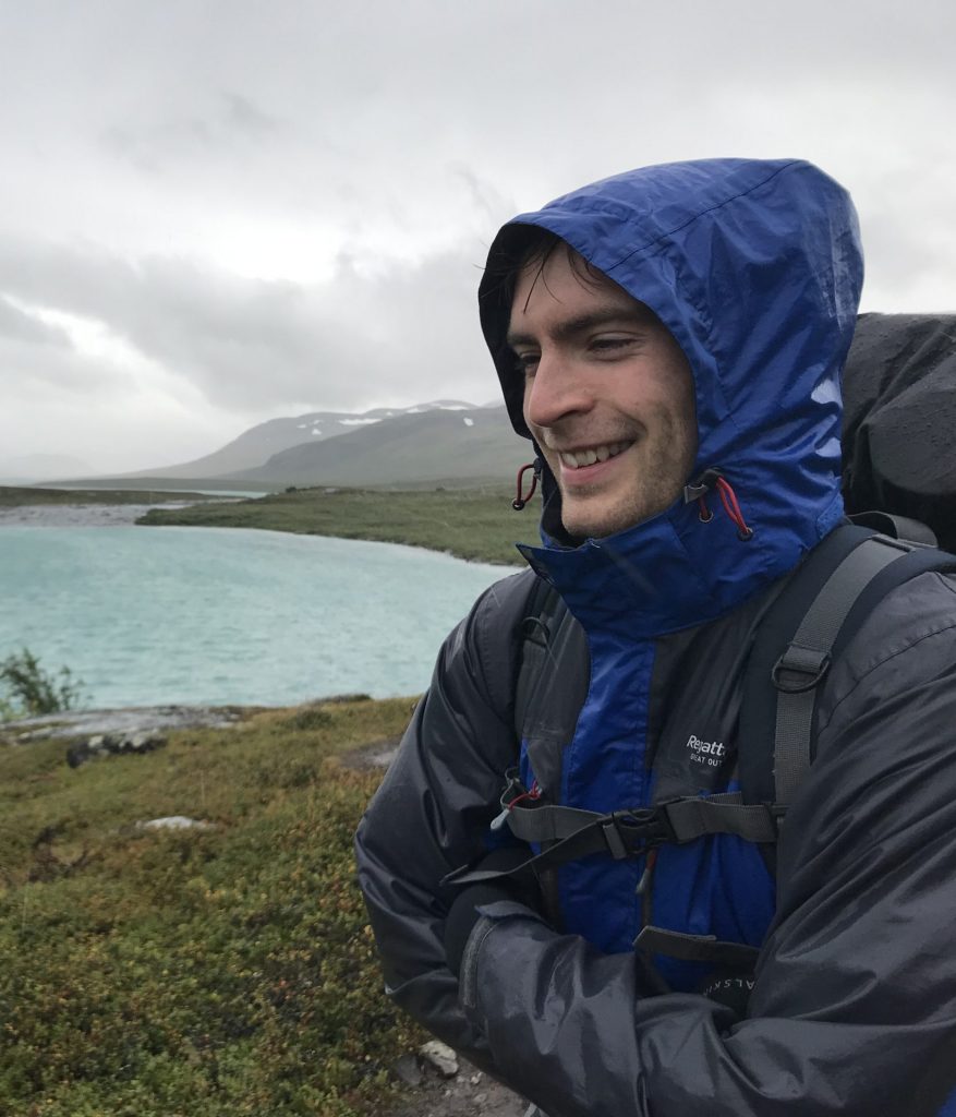
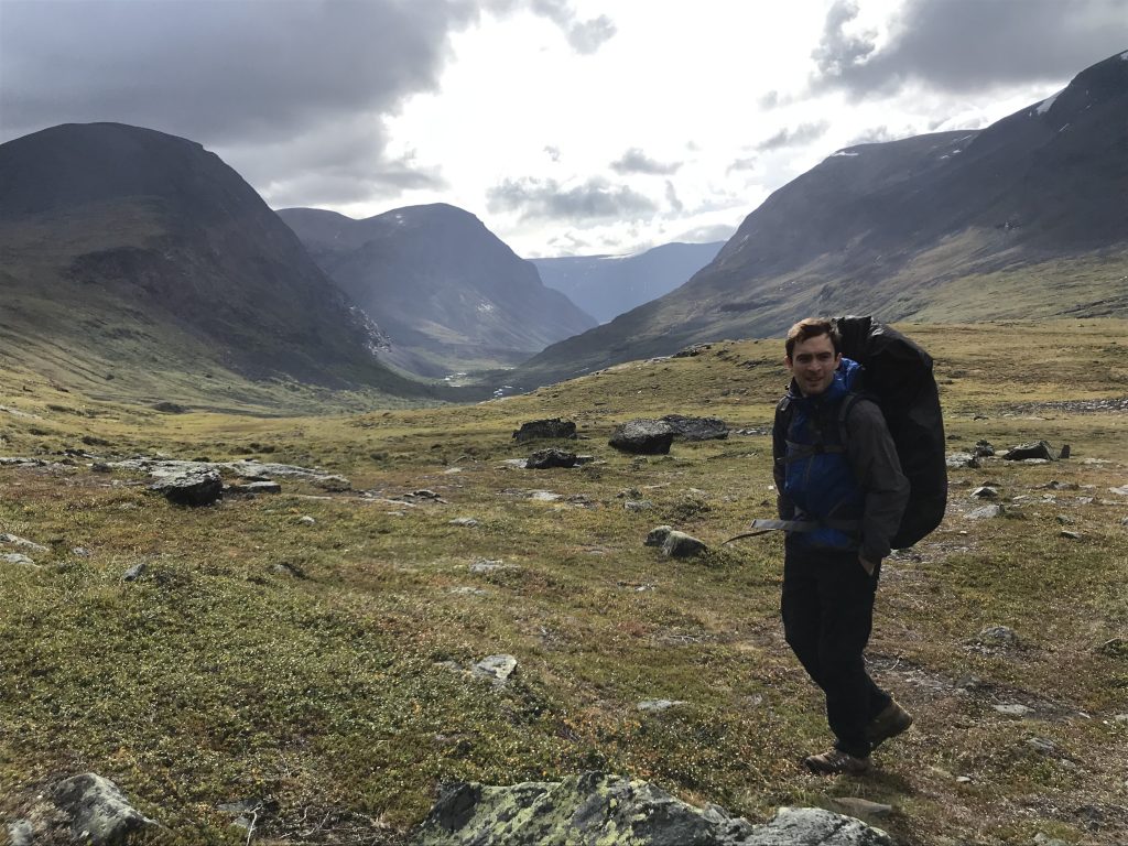
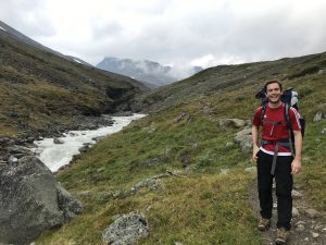
Our journey started on a Friday morning and involved a flight from London to Stockholm, another one up to Kiruna, and then finally a bus from the airport to Abisko – each leg taking us further North and into more remote landscape. Abisko is small village with a mountain station, which is a bigger version of the mountain cabins; they have luxuries like electricity, a shop and a restaurant. We arrived in the afternoon and Stu was keen to head straight out onto the trail. We were there in late August when the darkest it gets is ‘astronomical twilight’, so there were plenty of daylight hours to hike in, but I persuaded Stu to let us have a chilled afternoon with time to look into route options.
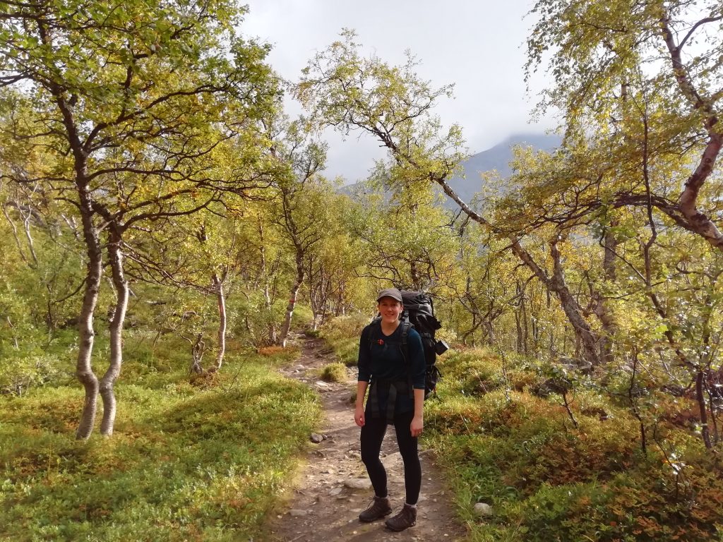
We checked in at reception, had our first brief argument over accommodation and then headed to set up our tent in the forest camping ground. On the upside, we soon afterwards discovered ‘kanelbulle’ in the small shop – the absolute best version of a cinnamon roll. We bought a detailed map and quizzed a tourist information lady about berries. There are a multitude of them covering the landscape up there and Stu wanted to know which were edible and where was best to find them, with the result that we planned our route to go into the Vistas valley in order to hunt for cloudberries (a golden delacy). Although there is one main trail, there are lots of offshoots and different cabins dotted about. We came up with three potential options to get to Nikkaloukta in eight days, with a manageable 15 – 20km to cover each day. In reality, none of these ended up being our final route.
Our last supper before days of super noodles and couscous was lovely. The restaurant served up a local dish of smoked reindeer and loganberries (this was before Stu went veggie). We enjoyed a pint and then said goodbye to civilisation for the week.
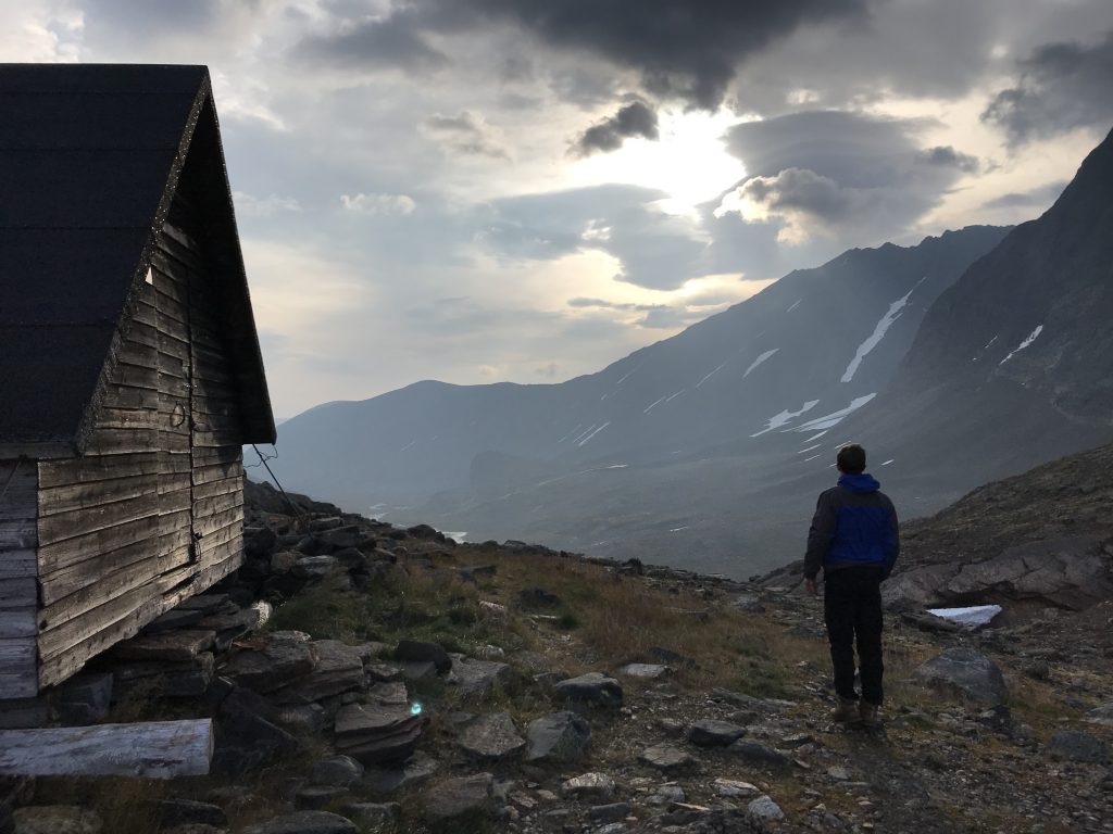
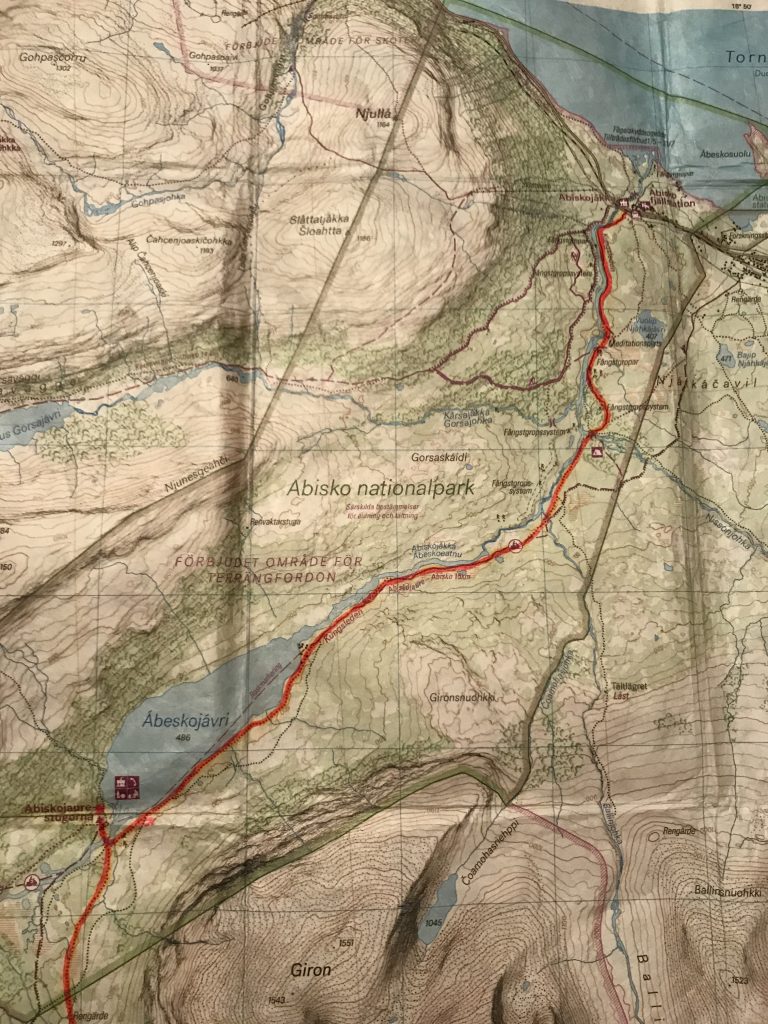
Abisko to Abiskojaure
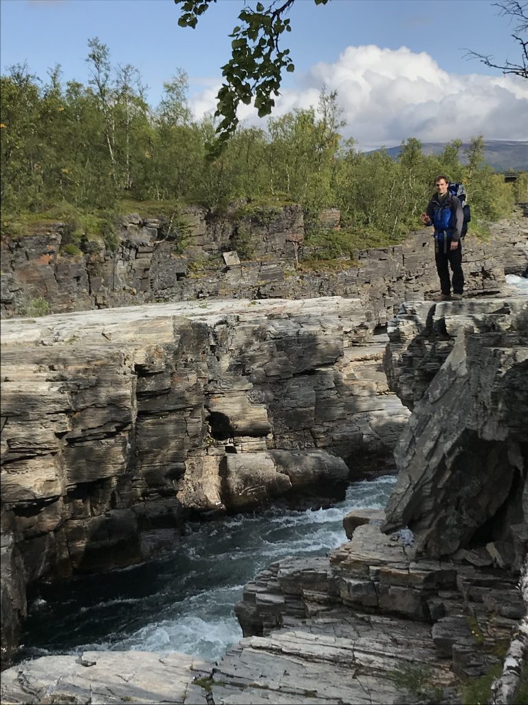
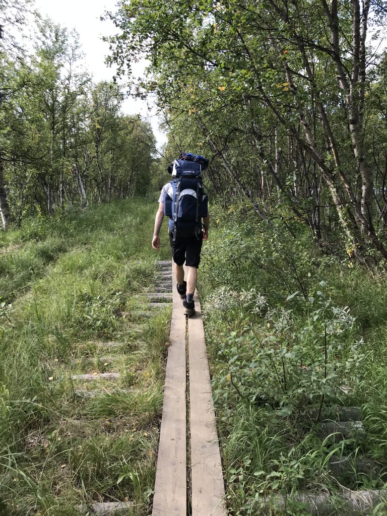
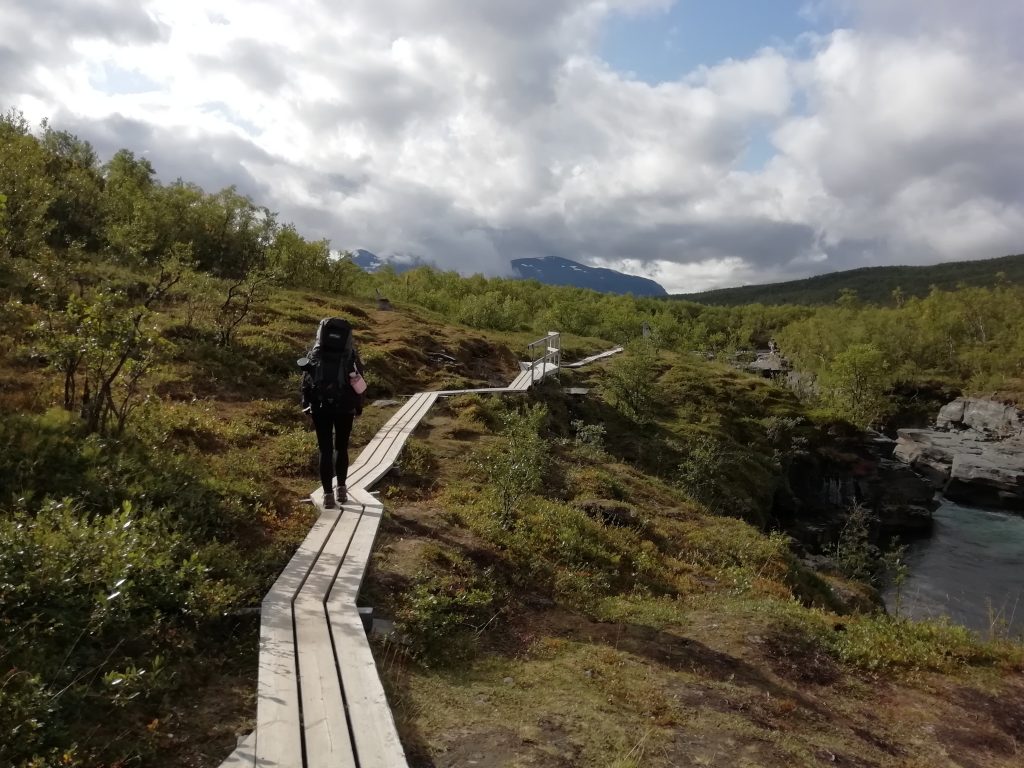
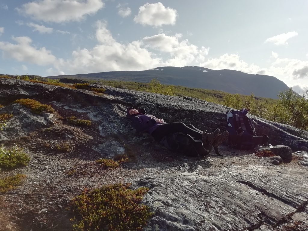
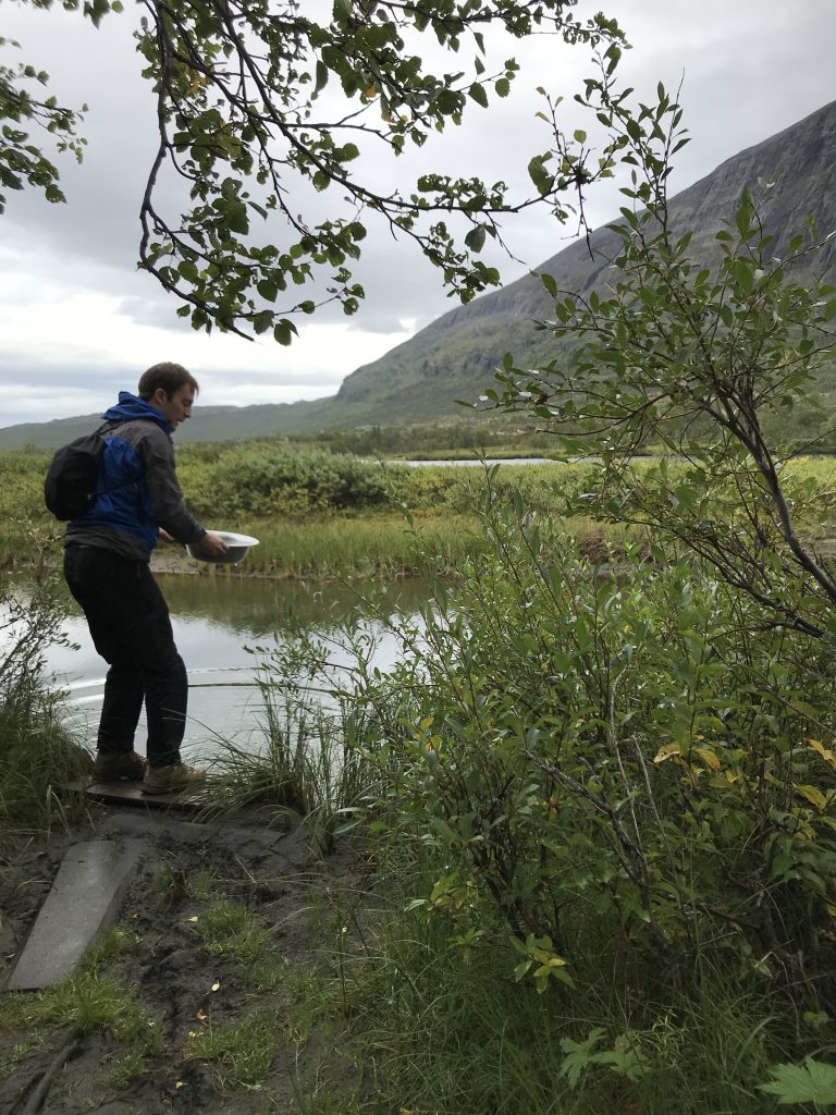
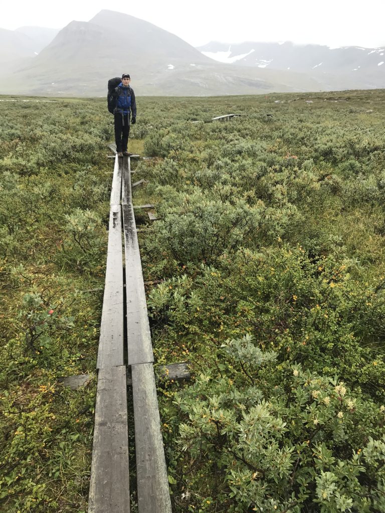
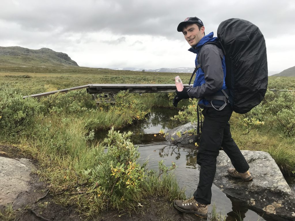
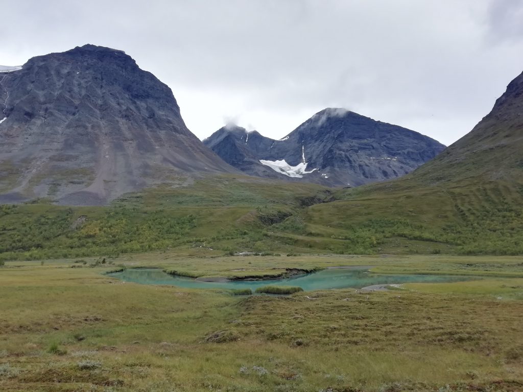
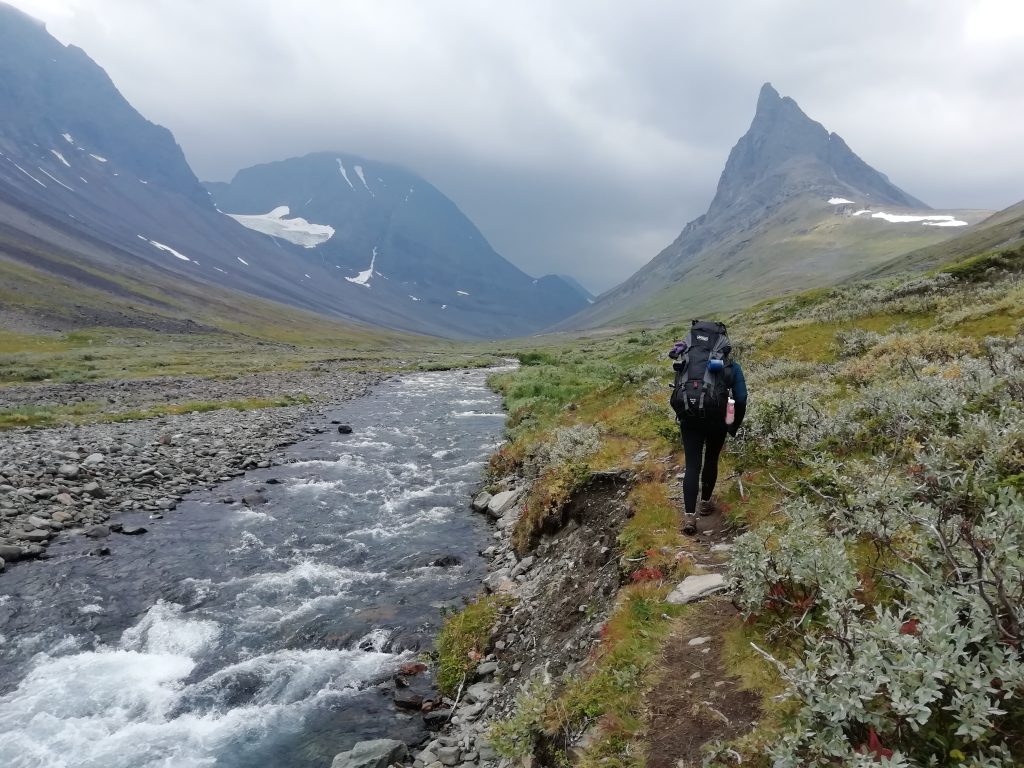
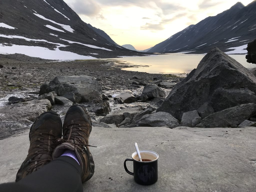
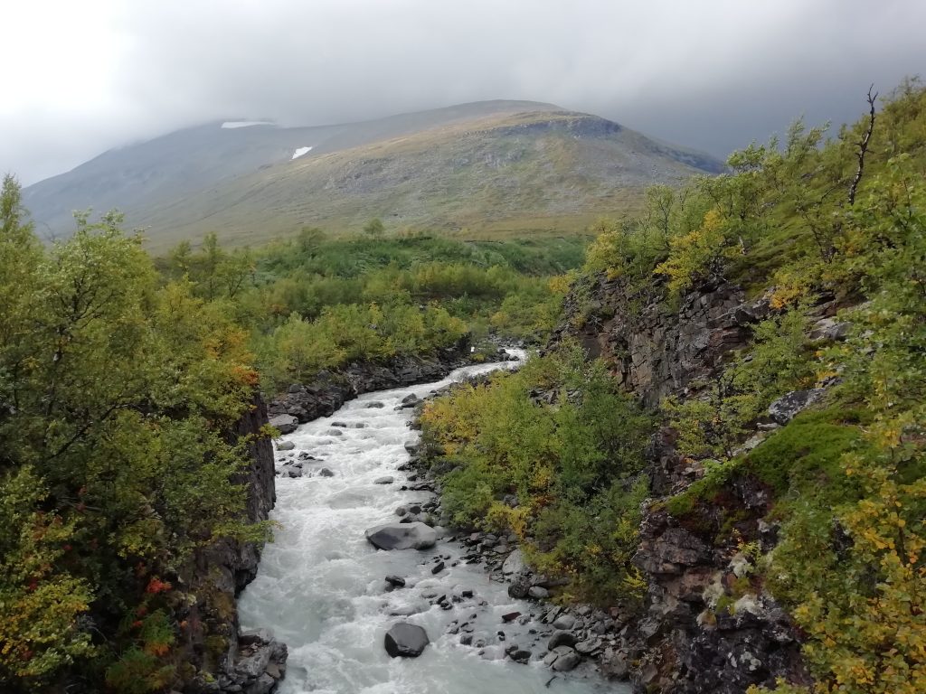
This first day of walking was pretty relaxed – we had 15km to cover, plenty of time and the path was easy going. It followed a river all the way to Abiskojaure (the first cabin), and wooden plank walkways are set up over uneven or boggy ground. The sun was out and we started slipping into the calmer mindset that creeps in from being outdoors and cut off from the usual stresses. We even stopped for a little nap on some rocks where the river opened out to a lake. We collected water from the river, at first using purifying tablets, but soon realising that glacier melt is pretty much the cleanest water we could drink and that the cabins all fill their drinking water tanks straight from the closest river or stream anyway. All our water over the week was sourced in this way, and luckily there is no shortage of it near any part of the trail.
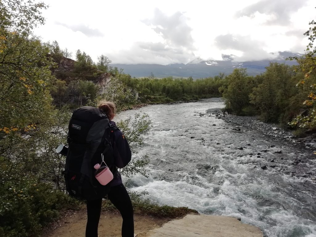
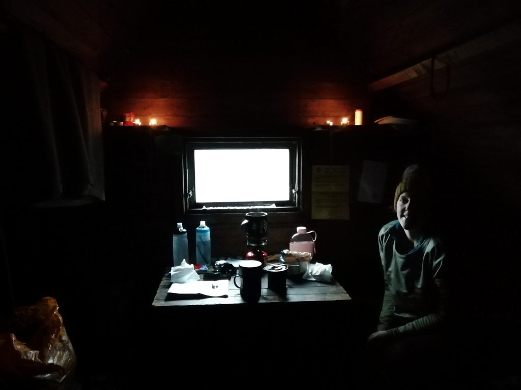
We arrived at Abiskojaure and set up camp (there are plots laid out on site and you can use the facilities for a reduced fee). The cabins are run like a hostel where everyone pitches in. You can chop wood, collect buckets of water for the kitchen, empty ‘slask’ (used dishwater) and generally keep everything tidy. We didn’t really know what we were doing, but copied people and soon knew our way around. There are gas stoves for cooking and heating up water. We’d bought most of our provisions in the UK – noodles, couscous, soup, porridge and cereal bars. There are tiny shops at the cabins, but the options are pretty much the same, except for chocolate which we stocked up on regularly. We were gifted some honey by a couple of London-based Australians who were on their last day going in the opposite direction, which greatly improved our breakfasts for the week.
The remaining facilities included compost toilets and a sauna. That’s right, no flushing toilets or running water, but almost every cabin has a wood-burning sauna. For prudish Brits, this was quite the experience. You can opt for a single-sex time slot, or go in a mixed session. Not wanting to brave the experience alone, we went for the mixed. We eased ourselves in by going near the end of the time slot when it had almost emptied out – preparing us only slightly for the next day when the small wooden box was filled with ten naked men and Stu and I in costumes. You really do just have to embrace the experience; a sauna after a day of hiking is a must, and this was pretty much the only opportunity for anything resembling a shower. There is an adjoining room in each sauna containing a tank of water that has been heated by the wood-burning stove. You use this and a scoop to clean yourself (or at least to try to remove the dirt at a quicker rate than the sweat from the sauna builds up). On this occasion, we followed up our sauna with a dip in the ice-cold lake nearby – which is apparently the done thing.
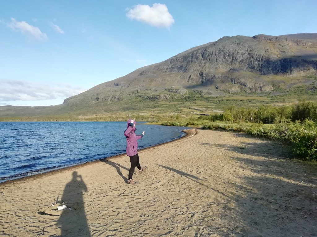
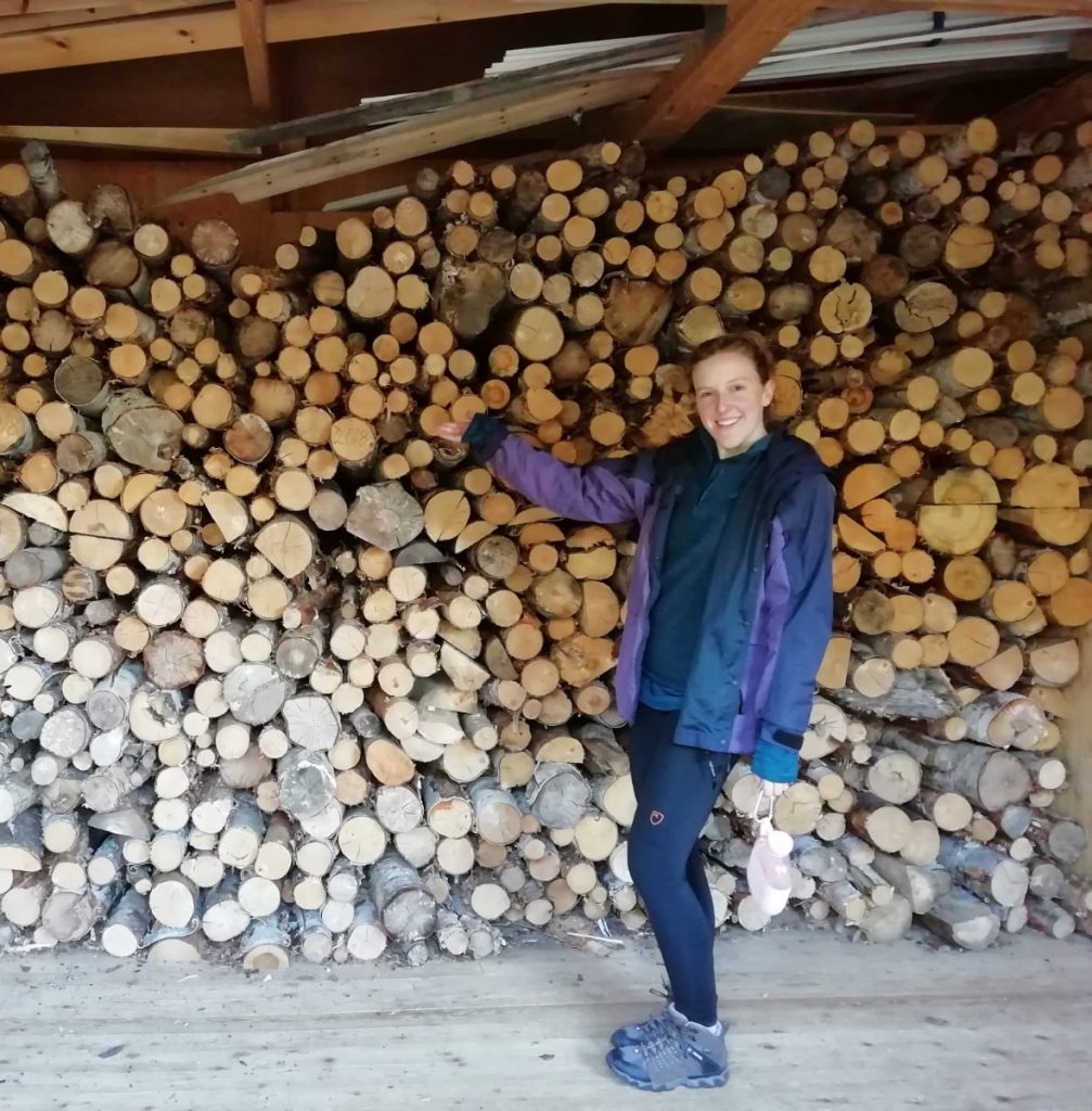
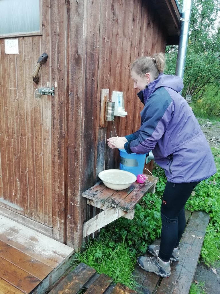
Here are photos of Abiskojaure, featuring Tai Chi on the lake’s beach, the log store and the hand washing invention of a tin with a hole in the bottom:

Abiskojaure to Alesjaure
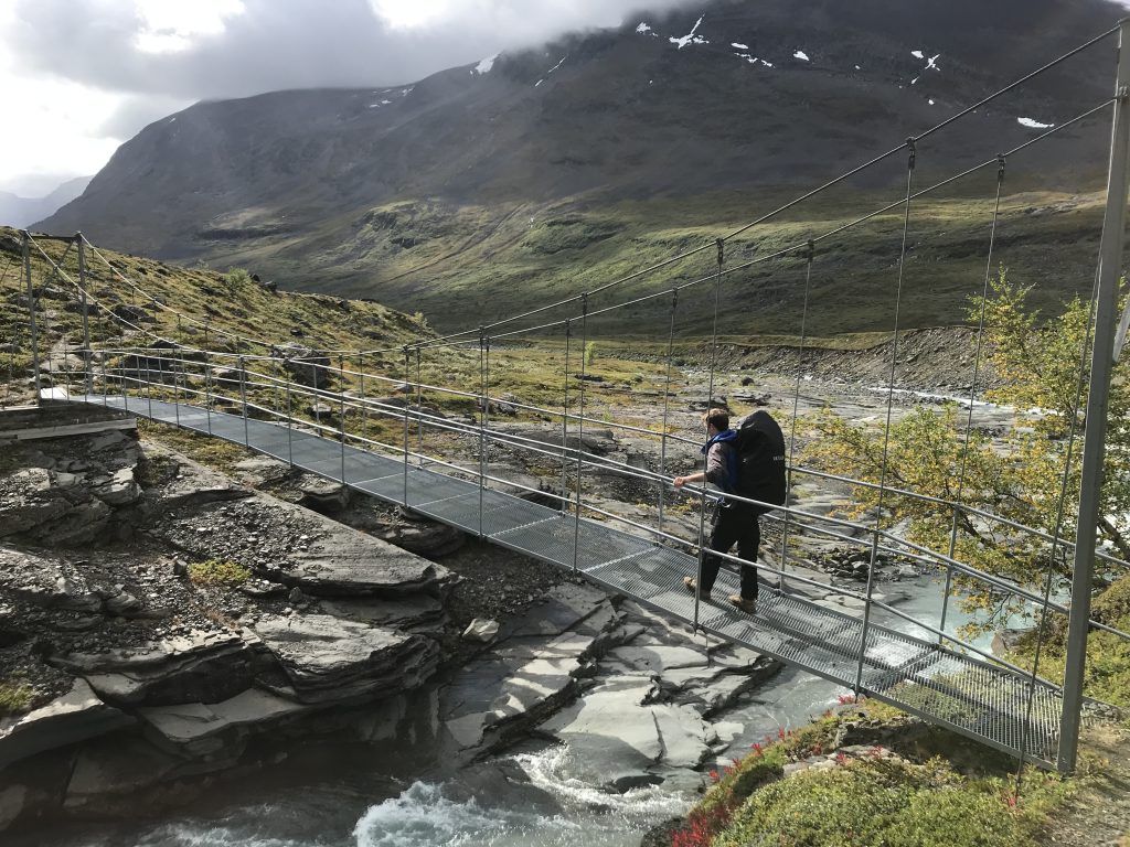
On to day two! Overly complacent from the ‘easy’ walking of the first day, we took our time packing up and set out a bit later than was advisable for the 21km of this leg. We had a couple of bridge crossings and then a nasty uphill where the weather took a turn for the worse. The rest of the day was spent battling wind and rain. We struggled on, making a friend on the way – a guy with some good stories from his time in the Liechtenstein army. We saw a bunch of other people too, mostly huddling at a small shelter offering a boat service that could take you the final 6ish km to Alesjaure. I would have happily joined them, but you can imagine how that suggestion went down.
When we finally arrived at the Alesjaure cabin, tired and wet, the weather was so bad that Stu agreed to a night in a hostel cabin instead of a tent. As my luck would have it, this was the busiest cabin checkpoint we came across and there were no beds left by the time we got there. They would have made a plan with a mattress on a floor, but since we had our tent anyway, back out into the rain we went to secure our tent as best we could into some particularly hard ground near the lake. We deserved the sauna on this day, and it had one of the best views. I let Stu go solo down the muddy slope to dip in the icy river this time, but he says he had a great time. The loos here were not to be sniffed at either (pun not originally intended, but actually quite apt) – they were perched on top of a rocky outcrop, with the result that you experienced an arctic breeze up the toilet while doing your business.
I swapped sleeping bags with Stu for this night (and actually every subsequent night I think). He had significantly upgraded his since starting out on this camping fad, meaning that my decent but very old one didn’t stand up at all when compared to his wonderful, squishy down duvet bag complete with additional drawstring to keep it close under your chin while allowing you to breathe. The dream. Apart from an interruption in the night when we heard a mouse scrabbling around our bags, we slept alright. In the morning, we discovered that the little bugger had eaten through Stu’s coat and bag and into the bottom corner of our porridge. He didn’t appreciate our choice of food as much as our Liechtensteiner friend’s though; a lot of his stuff was spoilt and the mouse was tame enough to stick around and gloat while we were all packing up.
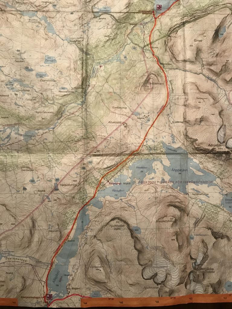
Alesjuare to Vistas
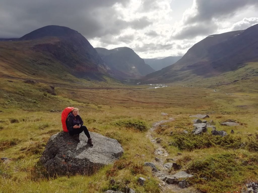
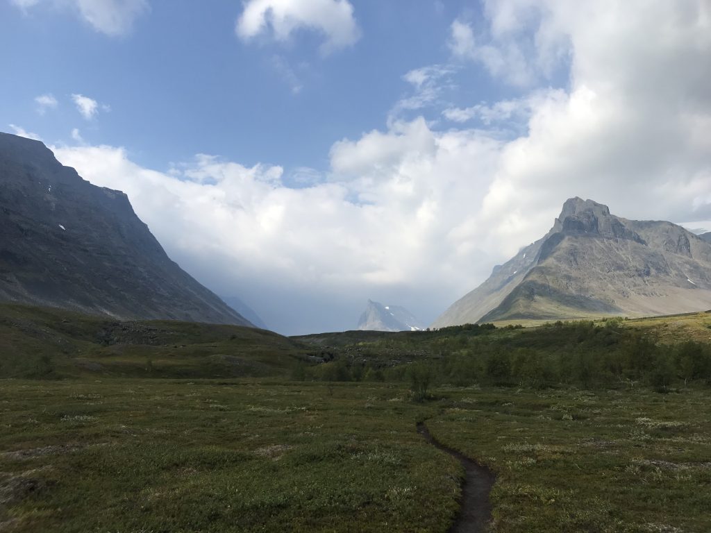
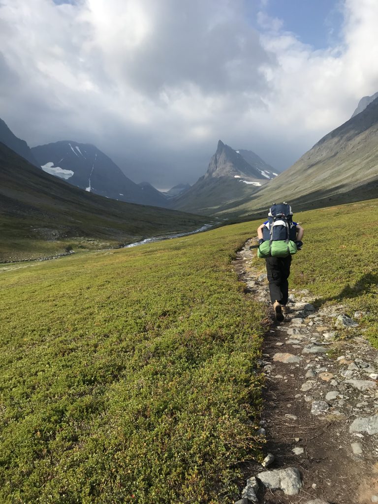
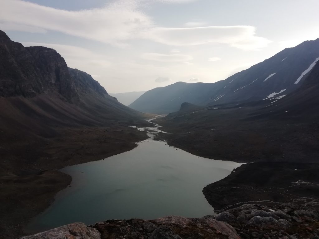
This is where we left the main Kungsleden trail. The lure of cloudberries, and of leaving the ‘bustle’ of the main route, led us down into the Vistas valley. Does anyone remember the dinosaur film ‘The Land Before Time’? The Vistas valley made me think of that – when they look down into their newfound green paradise at the end. The scale was just astonishing and we couldn’t do justice to it in our photos, but it was so beautiful.
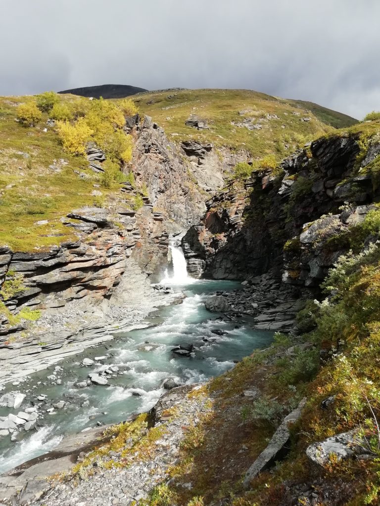
We dropped down into the valley and followed the trail along the river, finding nice spots for breaks and food. The scenery was just stunning. There were waterfalls, streams to jump over, a jumble of winding rivers and a section where you could see three different glaciers up on the mountains at the same time. The only drawback was that the deeper we got into the greenery, the more midges there were. This hadn’t been a problem at all yet, but clearly this area had perfect conditions for them. Standing still for any length of time piqued their interest, so we spent our second lunch / early dinner stop dancing around to avoid them and to save our gourmet meals of couscous mixed with soup sachets.
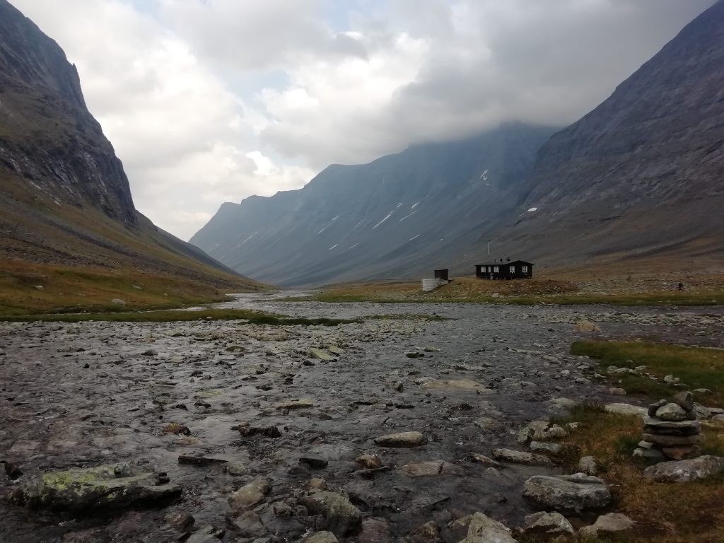
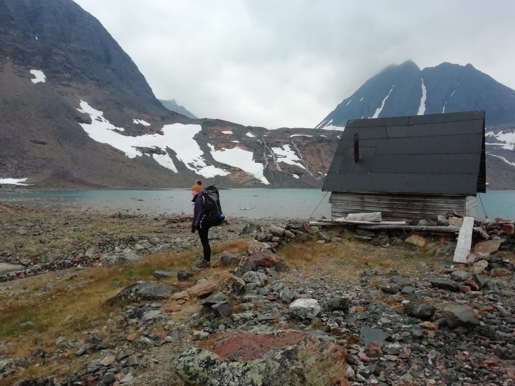
The Vistas mountain cabin is nestled in the greenery at the joining of two rivers. It was the most remote one we had seen so far, with just a couple of hostel rooms and a sauna (of course). We really should have chosen a bed on this night, because the midgie situation while camping was a disaster. We had to whip out our head nets – something we had brought hoping we would never have to use. We put up the tent as quickly as possible and then retreated to the cabin until bedtime. Another great sauna, another dip in an icy river, another candle-lit pasta dinner and route-planning session. The next checkpoint we had in mind was Tarfala, and there were a few options for us to get there – all involving some unmarked route navigation and an overnight stop away from a manned cabin. I was feeling a bit wary of this, but was put at ease by the lovely cabin host who looked over our planning and gave us some tips. But then we met Johan. He was a lovely, enthusiastic adventurer who told us about the ‘Yo-Yo trail’ across three valleys to Tarfala and convinced us that we simply had to see the ‘most beautiful arctic hiking’ in the world. He pointed out a tricky patch and told us to be careful there, but assured us that we would be able to handle it. We trooped back to our midge-infested tent with thoughts of how lucky we were to have met this guy and to be able to tap into his local knowledge. Oh Johan.
Vistas to Nallo
We woke up in the morning to a thick layer of bugs between the inner and outer layer of the tent – it was so gross. We shook them out as best we could and geared ourselves up for the day ahead. Each cabin has a sign in and out book, where you record when you arrived and what your next planned destination is – something to be referred to if people go missing I suppose. We joked with Johan about him seeing us on the news in a few days and set off.
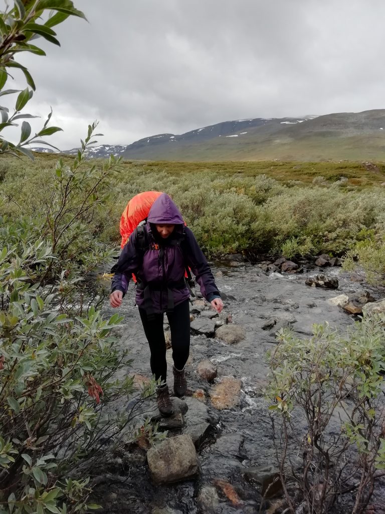
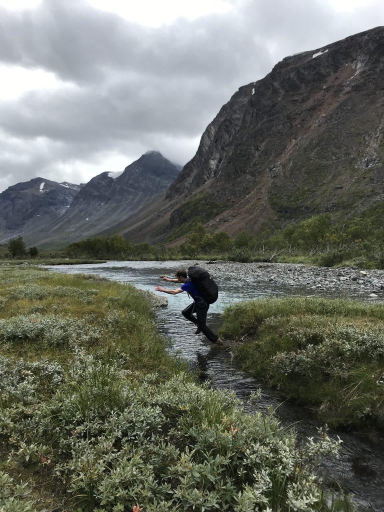
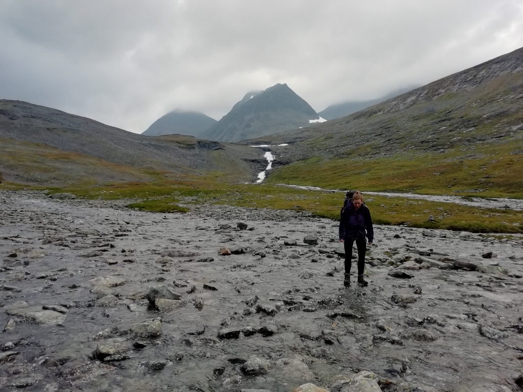
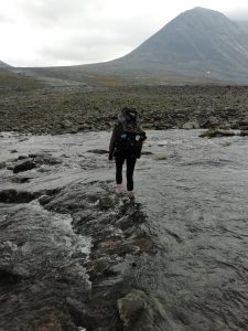
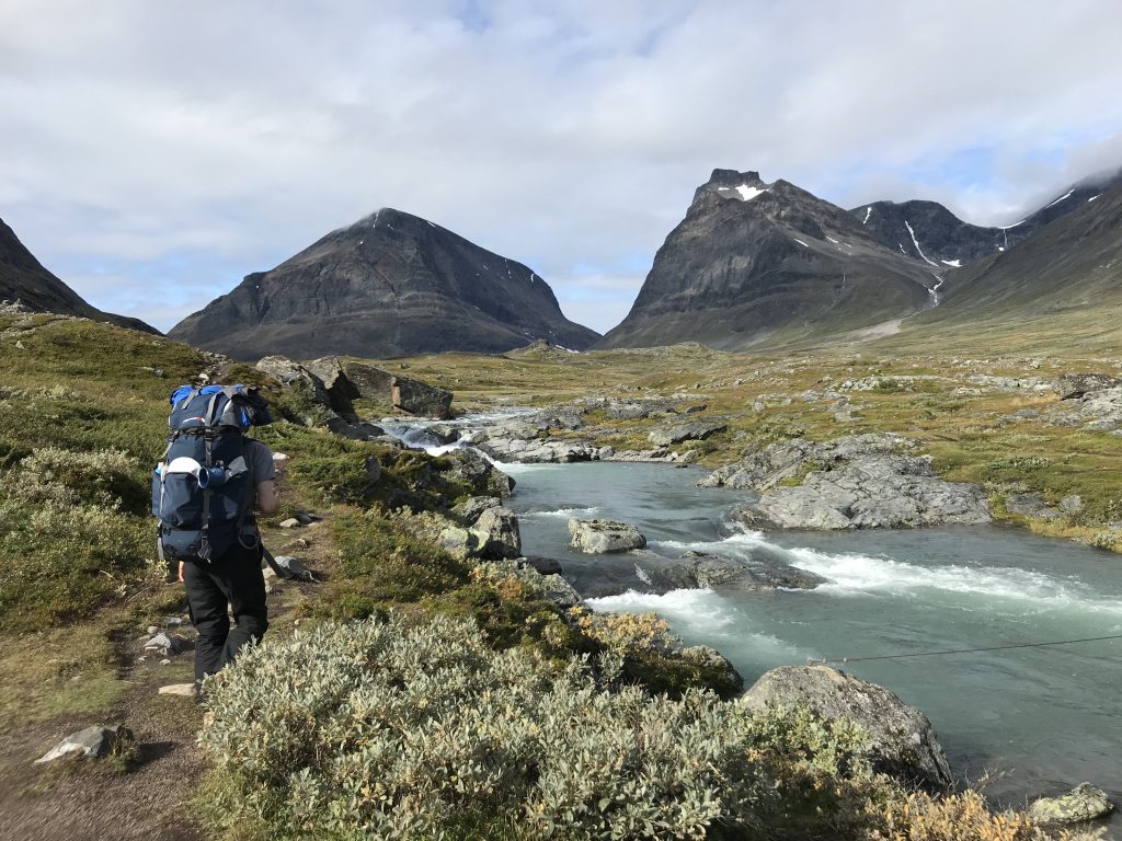
Our plan for the day was to walk the 10km to Nallo (another cabin), stop there for lunch and then head up onto the three-valleys trail. Nallo means ‘needle’, and is the name of the pointy mountain you can see at the end of the valley, with the cabin at it’s foot. It made a stunning backdrop. Our progress was slowed somewhat by our first serious river crossing of the trip. We’d jumped over streams and navigated across little rivers, but this was different; it was a network of streams flowing down the mountain to the main river – not deep, but fierce. Poles would have helped. We found a way through eventually, albeit with rattled nerves, only to find another one to cross at Nallo, this one wide and in full view of the cabin host who was probably despairing at our ineptitude.
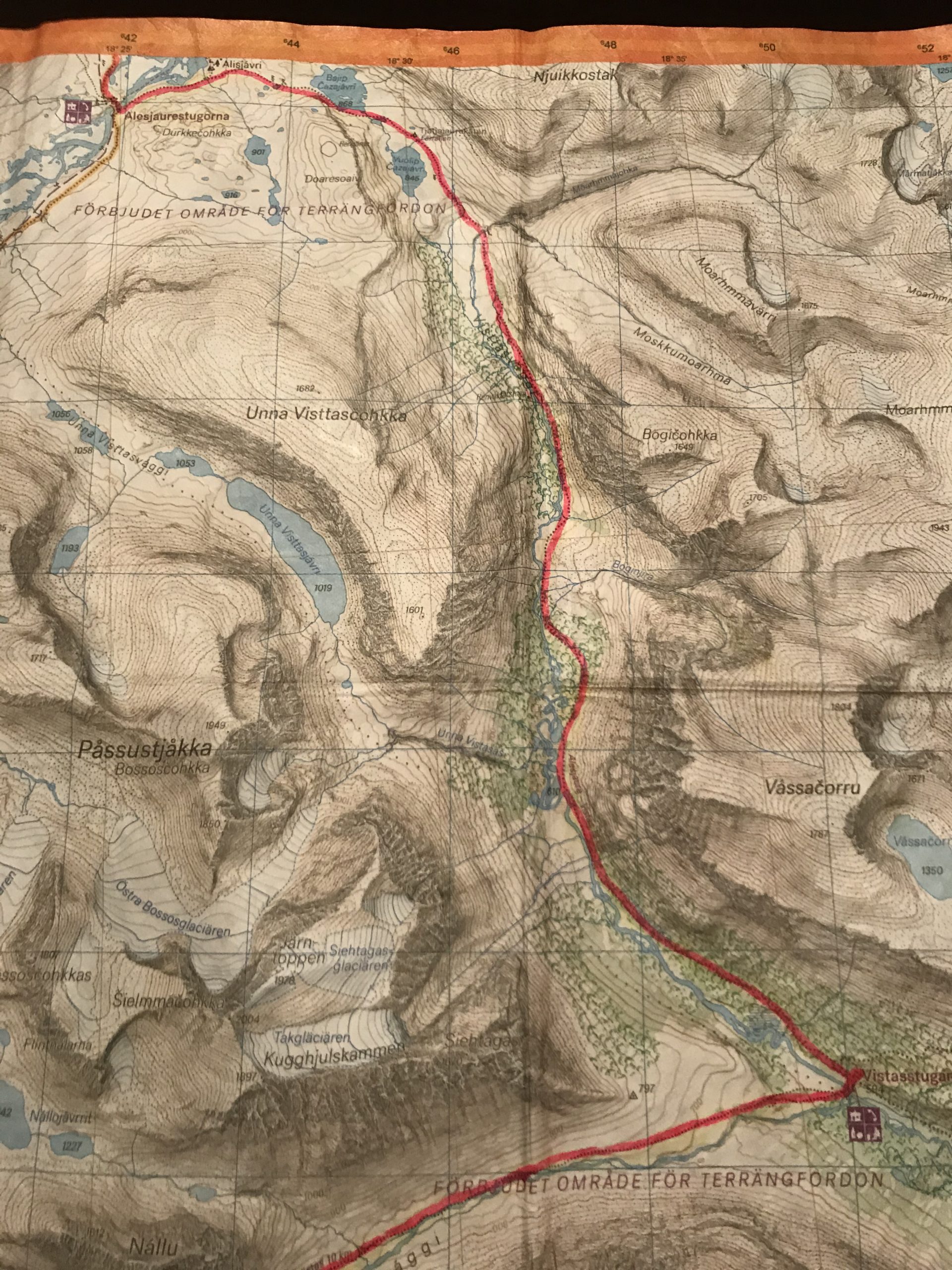
The Yo-Yo trail from Nallo to Tarfala
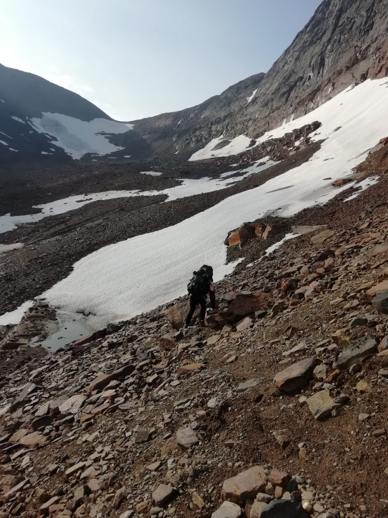
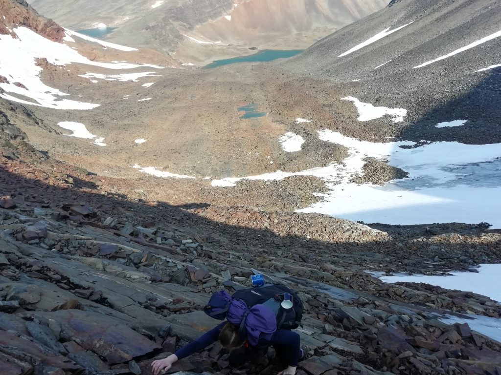
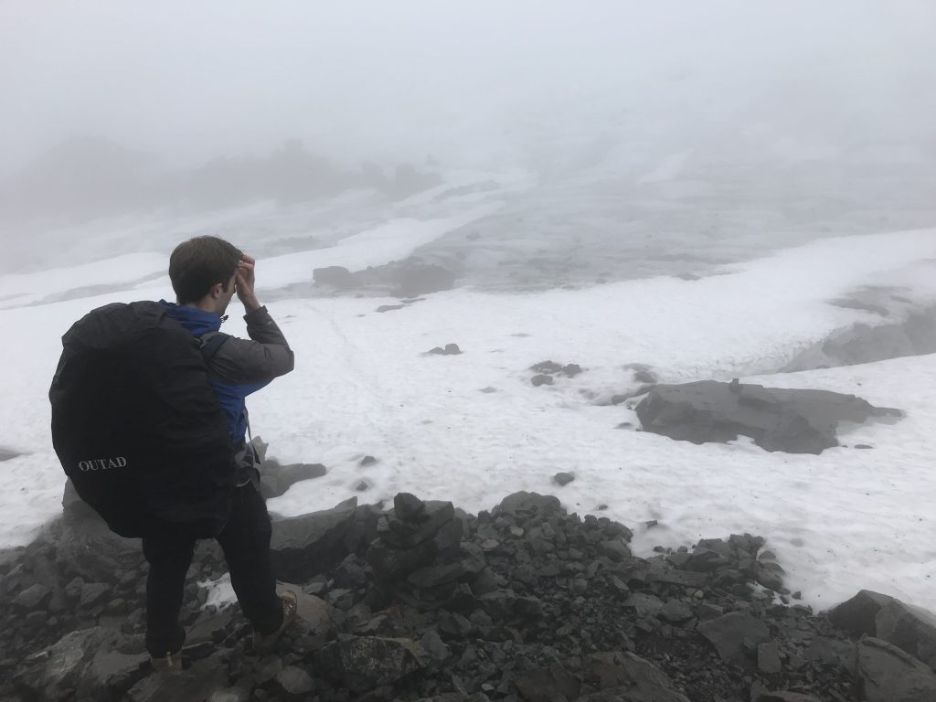
Right, this is where it gets interesting. We left Nallo after a quick, late lunch and started heading higher into the mountains to Unna Raita, an unmanned cabin where we were planning to spend the night. We were soon met with yet another river crossing, this one giving us no option but to remove boots and socks and carefully wade through. I was less than pleased by this point, but short of a 30km backtrack to Alesjaure via Vistas, we didn’t have a lot of choice. Again, poles would have helped.
The next 10km were a slog. The terrain had turned grey – no greenery up here, just rocks and glaciers. We were into the unmarked route section, so no clear path; just a compass, map and some cairns to mark the way. The trouble with cairns in a rocky landscape is that they blend in. The rocks turned to boulders as we approached Unna Raita, meaning that what looked like a simple section of the route turned into a bit of a scramble. I was fully grumpy by the time we reached the cabin. Even the ‘cairn you believe it’ puns were wearing thin.
It was wonderful to find, therefore, that the magical cabin Johan had promised us was in disrepair. Maybe it was the gloomy weather and eerie wind, but let me tell you, a horror film could be made there. Creaky splintered wood, a whistling hole under the door, a broken fireplace, and the top it off: spiders. First spotted by head torch while face down, stretching out with some yoga. This night was spent with our sleeping bags laid out on a plank of wood, drawstrings tight and head nets on. There was a visitors’ book in a rusty metal box secured to the ceiling, which thankfully did show recent entries – making me feel slightly less like we were totally cut off on a disused trail.
The return of the sun the next morning did dispel some of the creepiness, and I could appreciate that we were in a beautiful spot. From Unna Raita, we were due to climb up over a ridge into the next valley, and then repeat to get over into another one, and then another where we would reach Tarfala cabin. Distance wise, it could have been a one day trek, but we realised quite soon that we would have to stop over in one of the valleys. The day started with (yet another) painfully slow and chilly river crossing – this one with a lovely drop down to the lake below if we had a bad slip.
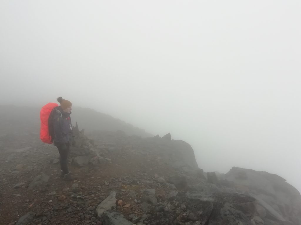
Next up was my least favourite bit of the trip, and in fact any trip we have been on. The whole mountain was essentially a pile of loose rock, and the ridge was steep. There was a snow field across one side which we were avoiding, but we couldn’t see a decent route up around it. At one point, we had to remove our packs in order to climb up a narrow section. I sat clutching the mountain while Stu lifted the bags up to me. I obviously wasn’t taking photos at this point, but here’s a few Stu managed:

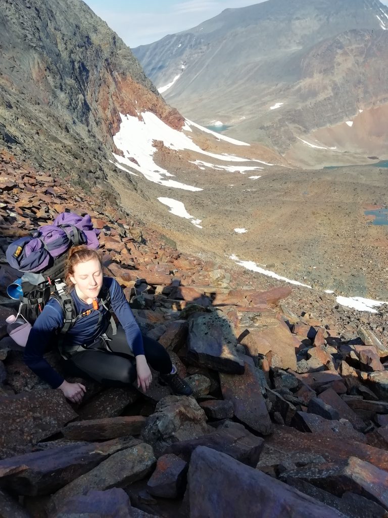
I’m not going to lie, I had a little cry at the top out of sheer relief. I’m sure that with a bit more experience this would have been fine, but honestly, if we ever meet that Johan guy again…
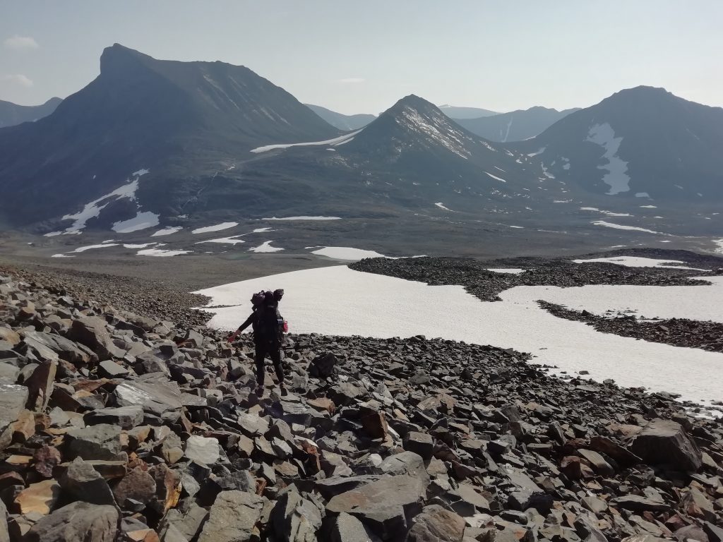
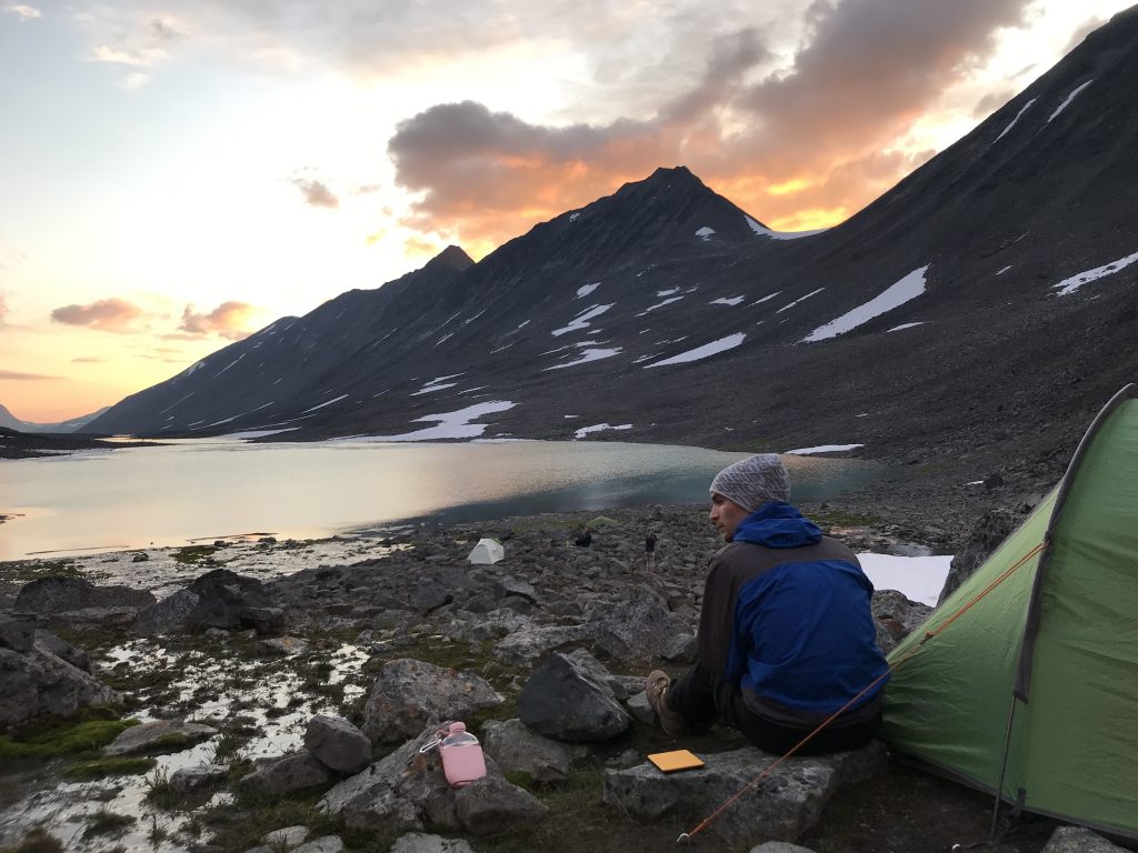
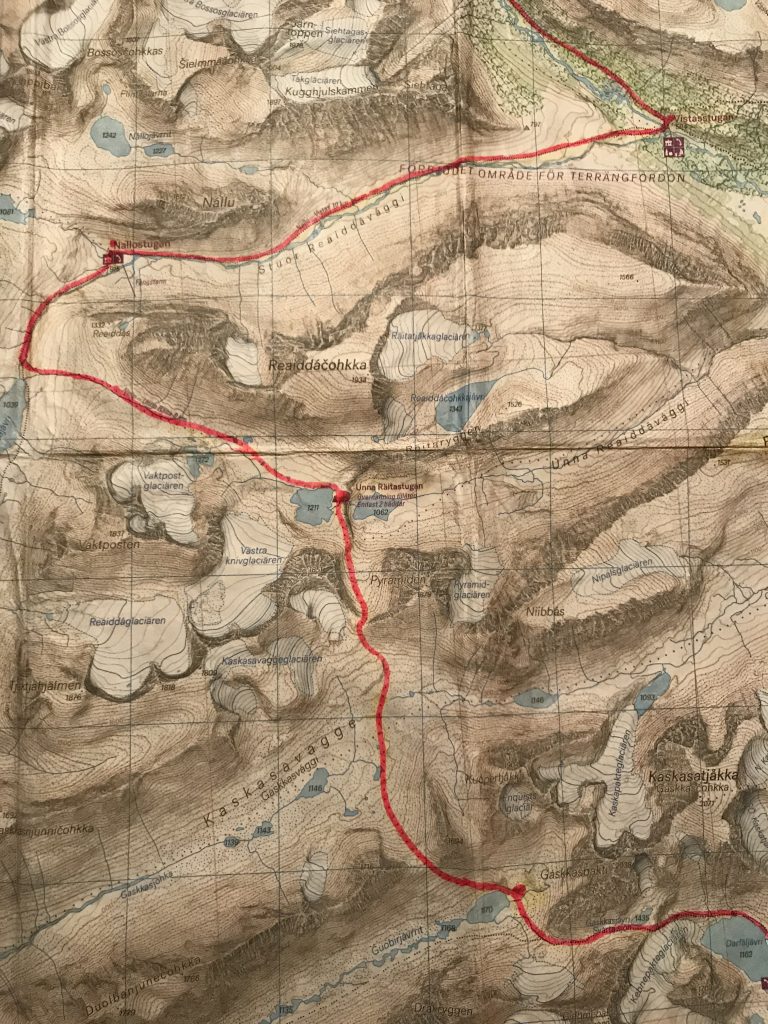
Onwards and downwards into the valley we went. The rocks were big and wobbly, making the weight distribution with our bags hard to manage. The worst was over though. We passed a group heading in the other direction; always nice to see another human face when feeling that remote. We had a brief break at the bottom of a valley called Kaskasavagge, then headed up and over the next ridge into Guobirvaggi. Going up was so much easier than clambering down, and by the time we made it down to the lake in the valley, we were ready to call it a day and set up camp.
Even though I was feeling pretty sorry for myself after this day, even I had to admit that I’m not sure we’ll ever top this for a camping spot. The sunset over the lake was fantastic; the view through the tent flap exquisite. We had a little wash in the glacial stream, made some dinner and perched on a rock to read until the sun went down. Two Germans appeared and set up camp nearby, and we had a good chat before heading to bed.
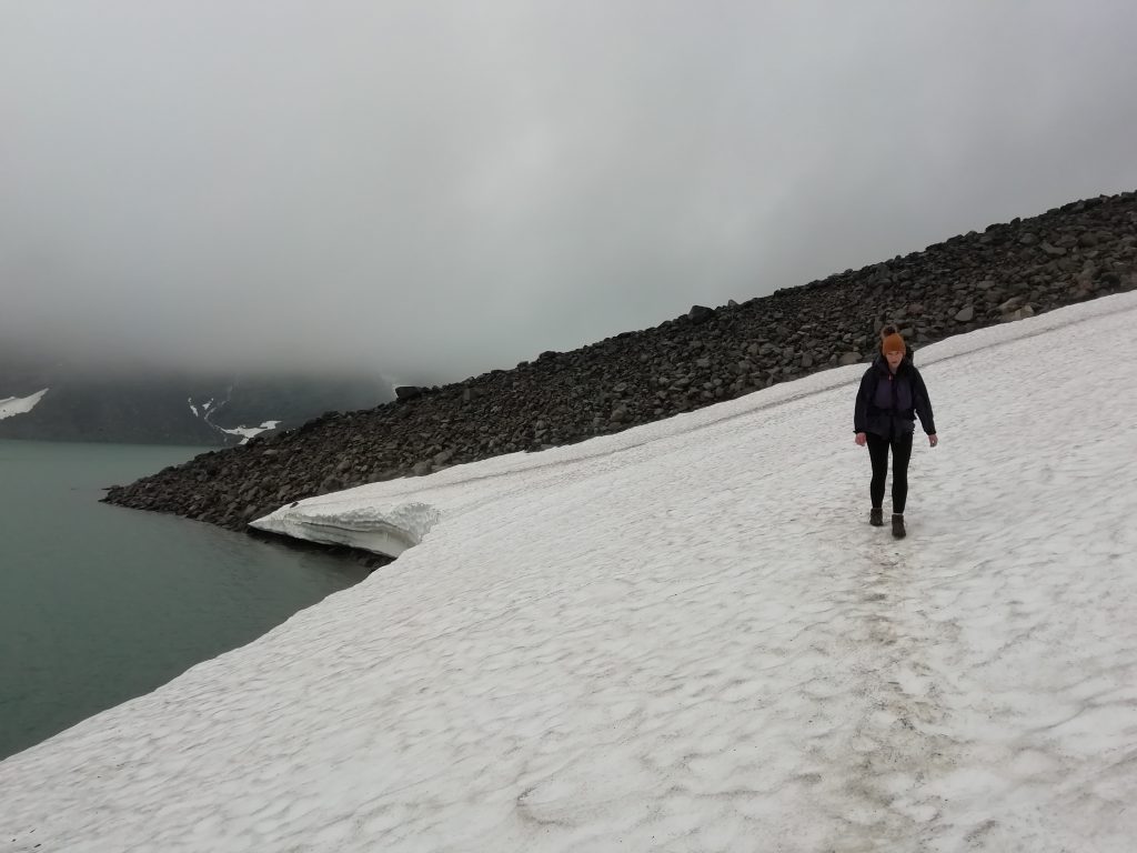
The climb up the next ridge was fine the next morning, but unfortunately the clouds rolled in soon after. We were looking for landmarks on the map, but couldn’t see much at all and had to just focus on following my compass east for a while. We rejoiced upon spotting what looked like a large cairn, only to get closer and find it was a memorial stone. Not what you want to find when you are lost in a cloud on a mountain. We got to the edge of a large snowfield which we weren’t expecting from the map, and sat down to try and wait it out. No such luck, but around 15 minutes later a man appeared – I can’t tell you how relieved I was. He had bumped into our German friends and they had asked him to look out for us. He let us know we were heading in the right direction and had to cross the snowfield; he said to head slowly and stay level across it. Yet again the lack of poles was an issue. The packed snow was slippery and required a bit of stamping to get each level foothold. Stu led the way, and I used his footsteps. It was almost a blessing that we couldn’t see very far, because there was a lake down the slope to our left that I didn’t fancy worrying about.
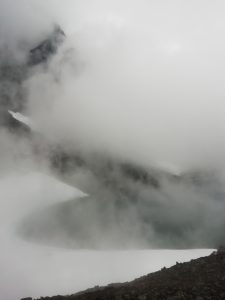
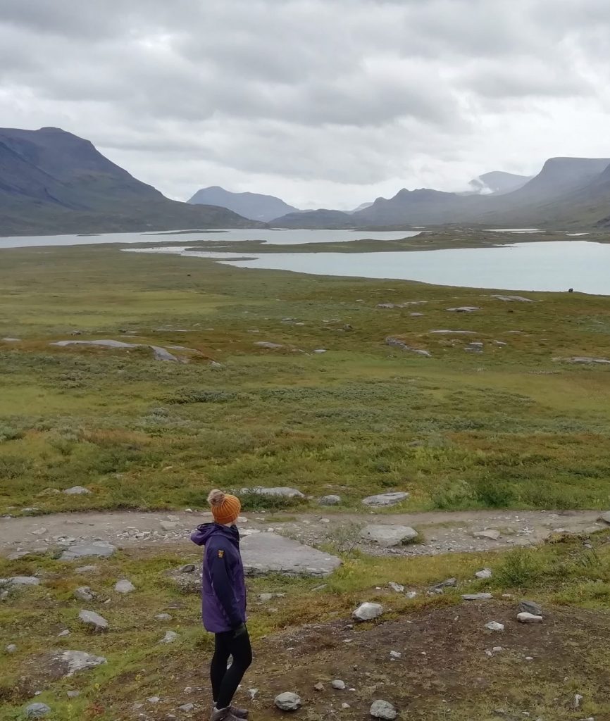
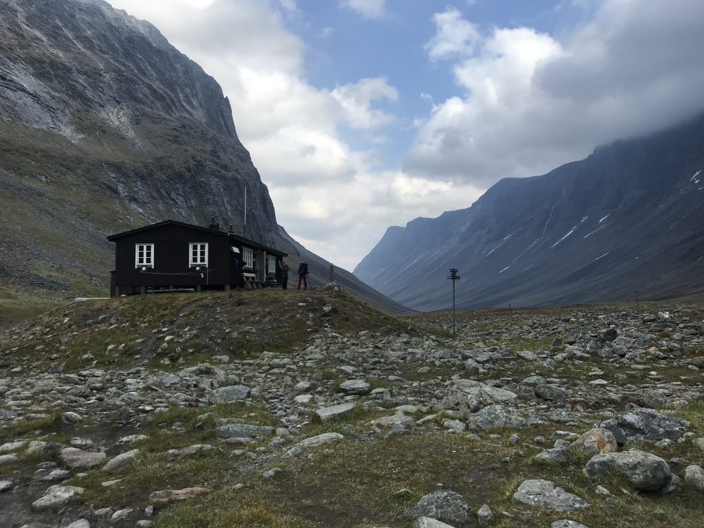
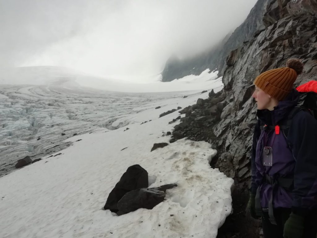
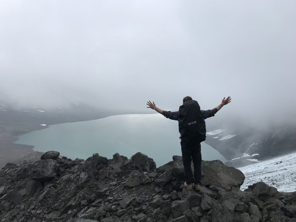
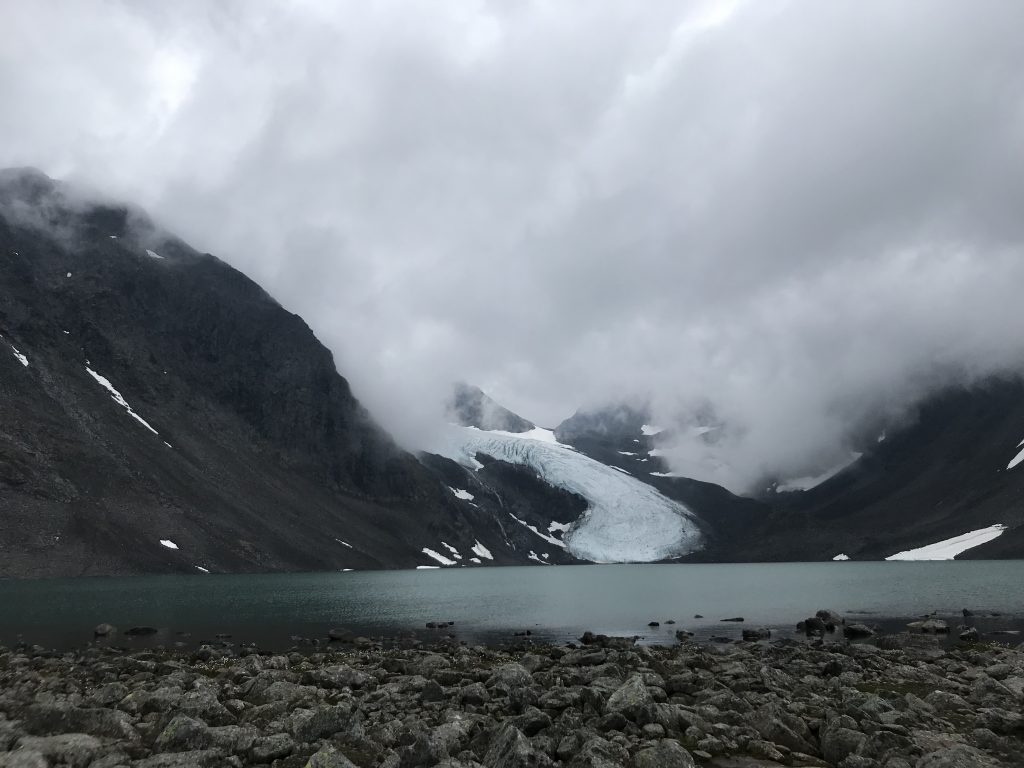
The next trial was the Kebnepakte Glacier, which the ‘path’ skirted around and on for a short distance to get past a steep rocky section. The bits of the glacier that we could see through the cloud were awesome; huge, deep rivets and blue lines. The clouds thinned as we dropped down towards Tarfala, at least giving us a good view of the lake and of the glacier when we looked back. A couple of snowfields and a few streams later, we made it to the cabin and rejoiced in the warmth, lunch and loos.
Tarfala to Kebnekaise
From Tarfala, it was a short 8km to Kebnekaise mountain station. That’s right, station, which means electricity and showers and a restaurant and a shop and beds. It was probably the quickest 8km we walked the whole week. This trail was well used, since lots of people do day trips from Kebnekaise, so was much easier going. We arrived at the mountain station and booked into a snazzy hostel room. And by snazzy, I mean that it had bunkbeds with actual mattresses. The shower was a dream, as were the kanelbulle and pints we located in the shop soon after. We bumped into the German couple we had camped with in the valley and who had been worrying about us – I’m not sure they thought we would make it out of the clouds. We booked into the station’s restaurant and were treated to three glorious courses of local food and wine. The station was teeming with people, most of whom were there to climb Mount Kebnekaise, the highest mountain in Sweden. We sat at long benches for the meal and chatted with the people around us. A very small part of us was thinking that we could tackle the mountain the next day, but that would have meant an early bed, crack of dawn start and a long final day of walking to make it back to Nikkaluokta in time. Instead, we spent the rest of the evening drinking and discussing the meaning of life with a lovely young couple from near Stockholm.
Kebnekaise to Nikkaluokta
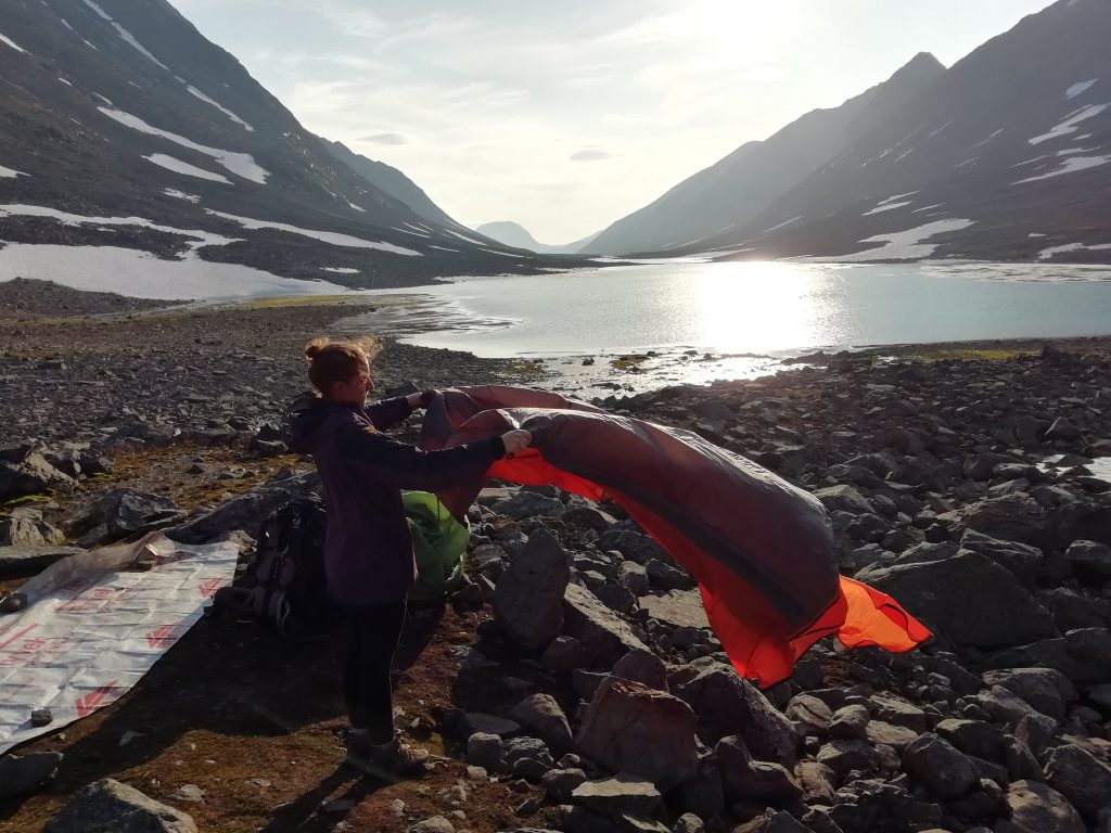
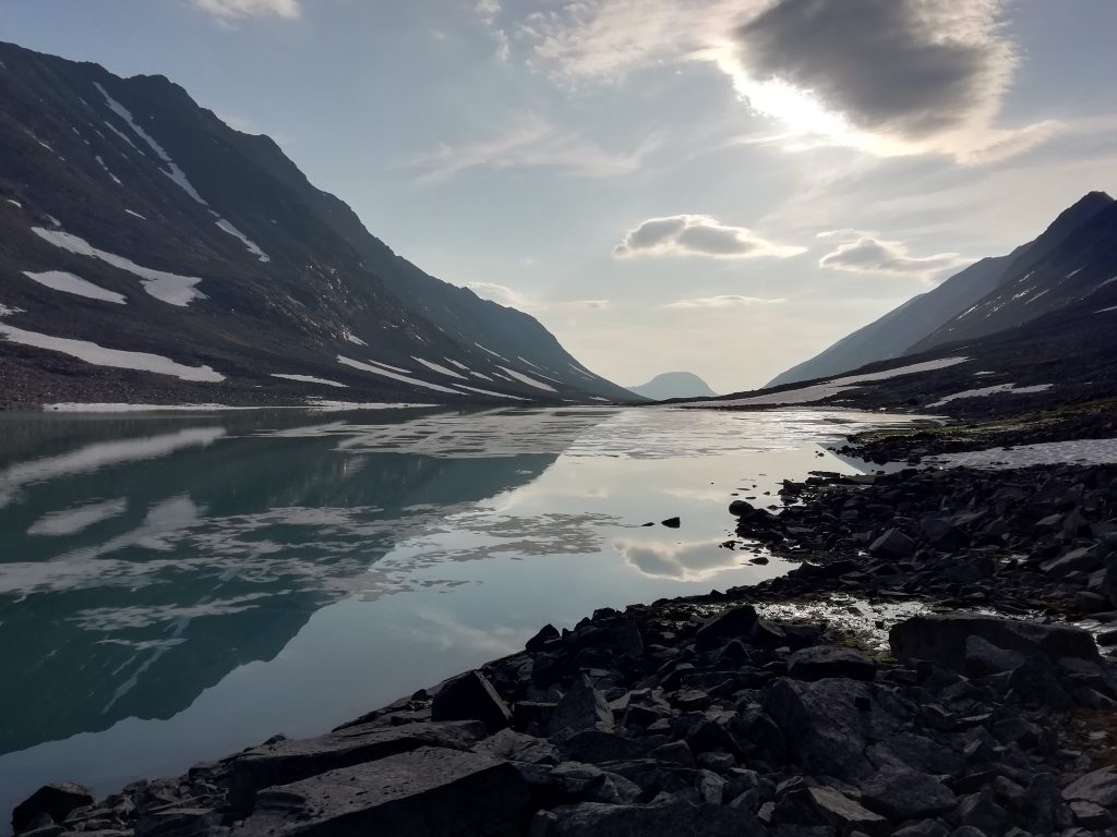
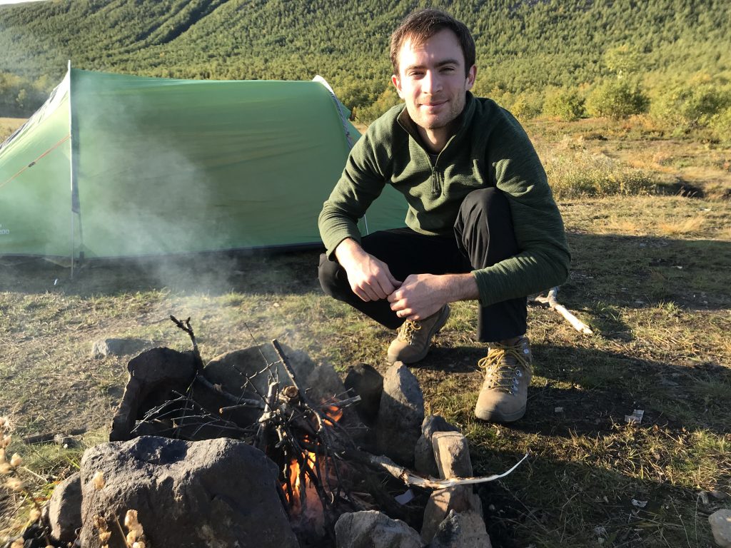
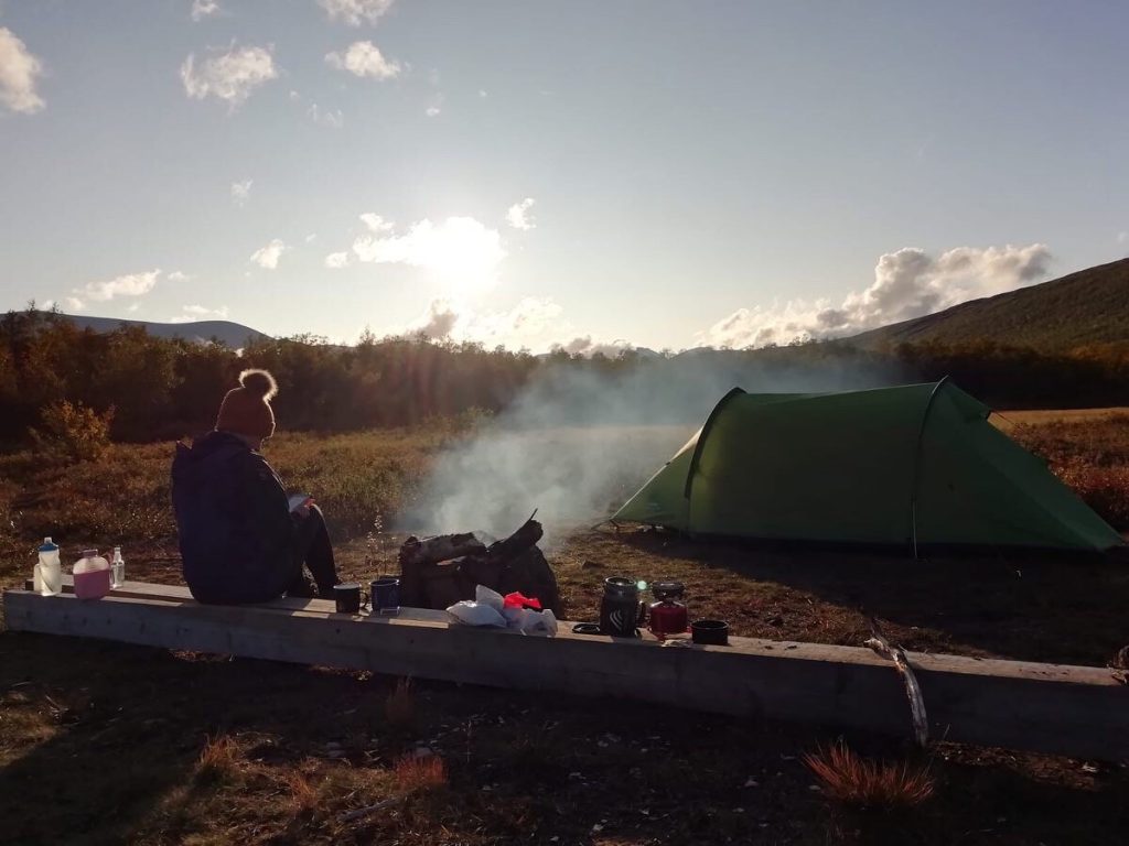
It was Friday morning by this point, and after a much needed all-you-can-eat breakfast, we made a leisurely start on the final leg of our journey, even taking a detour to explore some rock features near the mountain station. No more dramas to be had. We were back on the main trail, following a river along a valley. I highly recommend walking along valleys, rather than jumping across them. Since we had bags of time, we set up camp early and Stu fulfilled his lifelong ambition of building a proper campfire; it was great. We had a dip in a stream and enjoyed the evening sun.
The walking the next day took us step by step back into civilisation and away from any further failed attempts to forage for cloudberries. We saw a boat on a lake. We came across a cafe restaurant and ate reindeer burgers for lunch. We started worrying about the quality of the river water for drinking again. We then stumbled into Nikkaluokta, a place very well set up for people heading out and returning from the Kungsleden. We camped here, enjoyed our final sauna and tried to source our least smelly clothes for the bus and two planes that would take us home.
Phew, we made it to the end. This trip was classic Stu; far enough outside of my comfort zone to make me severely grumpy at times, but with enough adventure and beautiful scenery to make it worth it. I can see us going back to the Kungsleden in future – it’s so well set up for amateur adventuring and I highly recommend it (well, the main trail at least). Next time we’ll take walking poles.
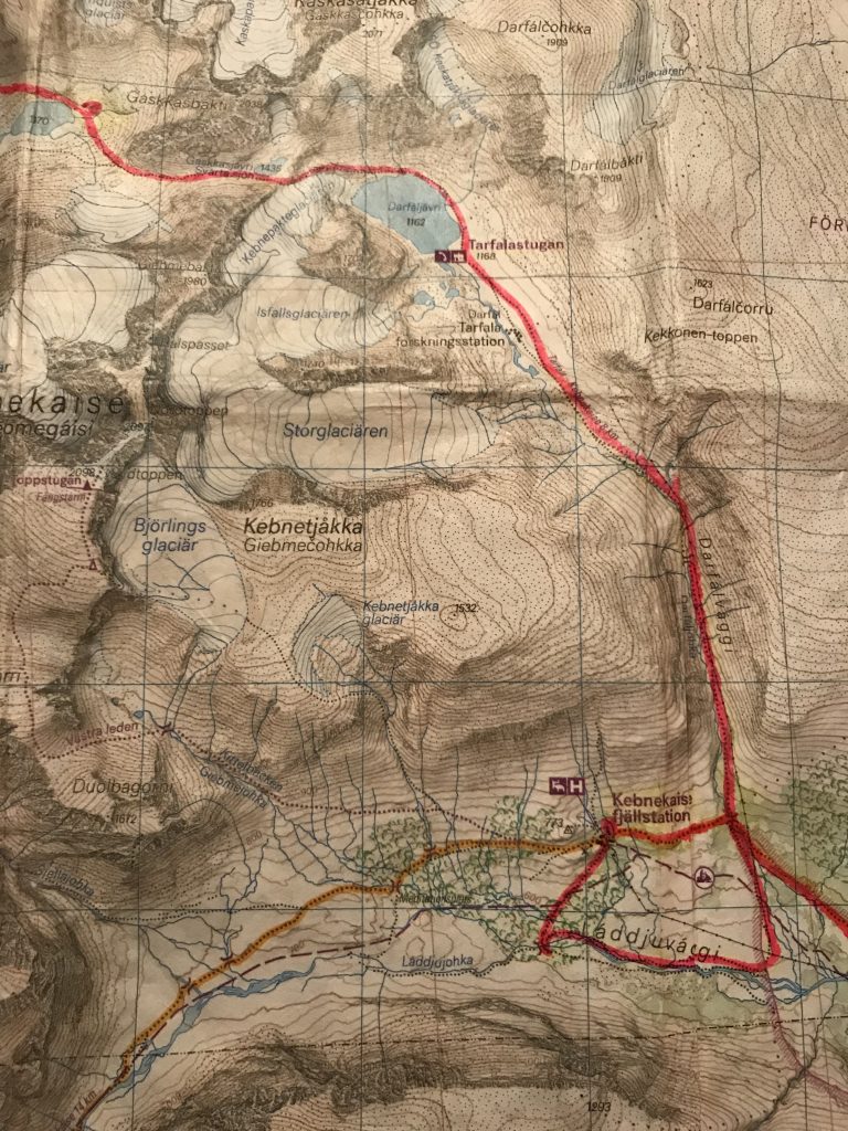
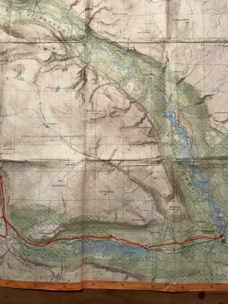
Here’s our well used map with our route marked in pink:
What an amazing experience and adventure…
Hi heading out in 10 days was there much camping to be found at the bottom of the 2 nd passes around the end of the lake Guobirjavrrit
ta peter